KPHTH?
Crete, general information about the island
Crete, the southernmost island of Greece and one of the most famous Greek islands for the English.
The Dutch and Flemish call this island Kreta, just like the Germans. The English say Crete, but the Greeks themselves say Kriti. Written in Greek capital letters, it may appear more like a code than a name for vacationers accustomed to the Latin script: KPHTH.

Crete, the largest island of Greece
Crete is a long strip of land that stretches 260 kilometers from east to west, bordering the southern part of Europe. It has an area of 8,261 km², making it the largest island of Greece. It is also the fifth largest island in the Mediterranean, just after Corsica. In length, Crete is almost as long as the Netherlands, and it is a large mountainous and limestone block, varying in width from 12 to 60 kilometers from north to south.

Mountain peaks and plains
The island has nine plateaus, varying in height and surface area. The highest is the Nida Plateau, located at an altitude of 1,400 meters, while the most famous plateau is that of Lassithi, with an average altitude of 887 meters.
There are three mountain peaks higher than 2,000 meters: the Dikti in the east, with a height of 2,148 meters; the Psiloritis in the central part, also known as Timios Stavros, with a height of 2,456 meters; and the White Mountains in the west, with the Pachnes peak standing at 2,452 meters.
Flowers, plants, and olive trees
In addition to mountains and plains, Crete is home to a large number of fertile plains. For example, the Messara Plain produces beautiful citrus fruits, and the entire island is covered with over 30 million olive trees.
The Cretan flora is of exceptional diversity; there are as many as 2,170 different species of plants and flowers. Of these, 311 are found nowhere else in Greece, and another 57 Asian species are unknown elsewhere in Europe.
Available Routaki routes:

The sea around Crete
Crete is located in the eastern basin of the Mediterranean Sea, approximately 300 km north of Africa and 160 km south of the Greek mainland. The island has a coastline of just over 1,000 km.
The island forms the southern boundary of the Aegean Sea. The sea just north of Crete is called the Cretan Sea (Greek: Κρητικό Πέλαγος). To the west of the island, the sea is called the Myrtoan Sea, and to the east, it is the Carpathian Sea. The southern coast of Crete is connected to the Libyan Sea (Greek: Λιβυκό Πέλαγος).
The Suez Canal and the Strait of Gibraltar ensure that the Mediterranean Sea remains an open sea.

foto gemaakt voor incrediblecrete.gr
Rivers and lakes
Crete does not have large rivers, and only one natural lake. Many of the small rivers on the island often dry up completely in the summer. Due to the mountainous structure, there is little space for nature to form large rivers. The rivers you can find on Crete are the Geropotamos and Anapodaris on the Messara Plain, the Tiflos and Kolenis on the plain near Chania, Kourtaliotis in Rethymnon, and Patelis near Sitia.
The most famous and only freshwater lake on Crete is Lake Kournas, near Georgioupolis. The lake in the Ida mountains near Zaros was man-made. Additionally, there are artificial lakes formed by the construction of dams, such as the lake near Avdou, created by the Aposelemis Dam.

Crete is largely made up of limestone

This porous rock easily allows water to pass through, leading to what are called karst phenomena. The water dissolves the limestone, creating caves, underground rivers, and lakes. Essentially, Crete is not a dry island, but the water is deep within the ground, making it difficult to bring to the surface. It is possible, but financially not feasible.

The island was part of the European massif until the Pleistocene (about 1 million years ago) and was part of a mountain range that connected Europe with Asia. As a result, the island is also located along a seismically active fault, where the African continent is sliding beneath Europe. Over the past few tens of thousands of years, Crete has risen several meters (in the west) or has sunk.
Earthquakes
This is also the cause of the regular earthquakes on the island. According to legend, the strongest earthquake ever wiped out the entire Minoan civilization. This earthquake was followed by a volcanic eruption on the island of Santorini, north of Crete. The crumbling rocks on Santorini caused a tsunami that swept away half of Crete. The volcanic eruption also created an ash layer about 15 meters high, covering large parts of Crete. After this quake, nothing was heard from the Minoans.

Narrowest part of the island (12 km)
Just before the village of Kalamafka in the Lassithi province, there is a viewpoint where you can see both seas. From this spot, looking north, you can see the Mediterranean Sea (also known as the Cretan Sea). To the south, you can see the Libyan Sea.
The isthmus here is only 12 kilometers wide. On the other side lies the Thrypti massif, with an elevation of 1,476 meters. On this side of the valley, you stand on a spur of the Dikti Mountains, which has a peak of 2,452 meters. There is a route that drives all the way around this mountain range.
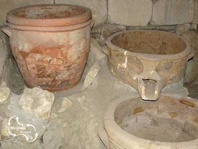
In the village of Vassilikis (at the beginning of the plain), excavations have taken place. A mansion dating from around 2500 BC was found. The style of pottery discovered in the house has been named after the site: the Vassiliki style. It is recognizable by the peculiar red and black spotted paintings.

Mountain Gorges
Most mountain gorges were formed around 14 million years ago when tectonic movements shifted and cracked the massive stone bodies of the mountains. Earthquakes have also influenced the formation of mountain gorges on the island.
On the southern coast, unlike the northern coast, the island has a more rugged appearance. The mountains seem to plunge into the sea, making the creation of gorges easier. The majority of the rock consists of limestone, which easily dissolves in water, further contributing to the formation of gorges.
The most famous gorge is the Samaria Gorge, located on the western side of the island. A 18-kilometer hike runs through this gorge. The Imbros Gorge is not far from there.
The Sarakina Gorge is also worth visiting. It offers a similarly beautiful hike, where you often walk through water during the early season.
To the east of Ierapetra is the so-called Butterfly Gorge, where there is also a lovely walk to take. Due to a fire, most of the butterflies are currently struggling to restore the gorge to its former glory.


The island of Dia
The island of Dia, located to the north of Heraklion, covers an area of 12 km² and has almost no buildings. There are some shepherds who live there and care for their flocks of sheep and goats. Daily boat trips to this island offer visitors the chance to explore interesting snorkeling spots.
On the island, the kri kri goat is kept. This protected mountain goat has a beige to brown color and a gray stripe running down its back. The animal has long, curved horns that bend backward over its back and can grow up to 70 cm long.
The goat’s actual name is Agrimi, but it is called Kri Kri, thanks to former U.S. President Truman. He was given a mountain goat as a gift but couldn’t pronounce its name, so he called it Kri Kri. Unfortunately, this goat died after just one day, as it had been taken out of its natural habitat.
In the wild, these goats are now nearly extinct. They can also be found in the Samaria Gorge and on a small island off the coast of Agios Nikolaos.


The small island to the right of Dia is called Paximadi. There is a story that Dia was a dragon, and that it would eat its bread. Paximadi is the name for the dried bread that is available in supermarkets and bakeries. This bread has a very long shelf life. It resembles rusks and is usually made from brown bread. On menus, it is called Dakos, where it is topped with feta and pureed tomato.
Because the islands are so small and dry, they are also named after this bread.

City walk Heraklion – GPS audio tour.
You can experience this vibrant city with the interactive GPS app VoiceMap. Install the app for free and select ‘Heraklion’.
In the webshop on this site, you can purchase a code that provides access to all the information you need to enjoy a fantastic day in Iraklio.
Would you like to get an impression first? Then start by reading this page about Heraklion.

Or, first, you read one of the following articles:
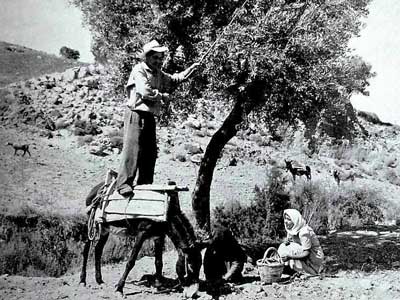
Olive harvest goes way back in time. How was it done many centuries ago
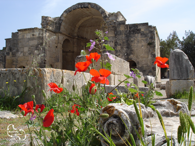
Once the capital of Crete – Gortyna, with the oldest Titus Basilica
Details of the Cretan wine making – more and more a real quality product.